Log In


Upper Nile, South Sudani
| Regional Level Types | |
|---|---|
| Upper Nile | State |
| South Sudan | Country |
This page is currently not sponsored. Click here to sponsor this page.
Type:
Largest Settlements:
| Place | Population |
|---|---|
| Malakal | 160,765 (2017) |
Other Languages:
French:
Nil Supérieur, Soudan du Sud
German:
Obernil, Südsudan
Italian:
Alto Nilo, Sudan del Sud
Russian:
Верхний Нил, Южный Судан
Simplified Chinese:
上尼罗省, 南蘇丹
Spanish:
Alto Nilo, Sudán del Sur
Arabic:
أعالي النيل, جنوب السودان
Belarusian:
Верхні Ніл, Паўднёвы Судан
Bengali:
আপার নীল, দক্ষিণ সুদান
Breton:
Nil Uhel, Soudan ar Su
Bulgarian:
Горни Нил, Южен Судан
Catalan:
Nil Superior, Sudan del Sud
Cebuano:
Upper Nile, Habagatang Sudan
Danish:
Upper Nile, Sydsudan
Dutch:
Upper Nile, Zuid-Soedan
Esperanto:
Supra Nilo, Sud-Sudano
Farsi/Persian:
نیل بالا, سودان جنوبی
Finnish:
Upper Nile, Etelä-Sudan
Georgian:
ზემო ნილოსი, სამხრეთი სუდანი
Greek:
Άπερ Νάιλ, Νότιο Σουδάν
Gujarati:
અપર નાઇલ, દક્ષિણ સૂડાન
Hebrew:
מדינת הנילוס העליון, דרום סודאן
Hindi:
ऊपरी नील, दक्षिण सूडान
Indonesian:
Nil Hulu, Sudan Selatan
Japanese:
上ナイル州, 南スーダン
Kannada:
ಅಪ್ಪರ್ ನೈಲ್, ದಕ್ಷಿಣ ಸುಡಾನ್
Korean:
상나일주, 남수단
Latvian:
Augšnīla, Dienvidsudāna
Lithuanian:
Aukštutinis Nilas, Pietų Sudanas
Macedonian:
Горен Нил, Јужен Судан
Malay:
Upper Nile, Sudan Selatan
Marathi:
अप्पर नाईल, दक्षिण सुदान
Norwegian:
Upper Nile, Sør-Sudan
Occitan:
Nil Superior, Sodan del Sud
Polish:
Nil Górny, Sudan Południowy
Portuguese:
Alto Nilo, Sudão do Sul
Romanian:
Statul Nilul Superior, Sudanul de Sud
Serbian:
Горњи Нил, Јужни Судан
Sinhalese:
ඉහල නයිල්, දකුණු සුඩානය
Swahili:
Jimbo la Nile ya Juu, Sudan Kusini
Swedish:
Övre Nilen, Sydsudan
Tamil:
அப்பர் நில், தெற்கு சூடான்
Telugu:
ఎగువ నైల్, దక్షిణ సూడాన్
Thai:
ไนล์ตอนบน, ซูดานใต้
Traditional Chinese:
上尼羅省, 南蘇丹
Turkish:
Yukarı Nil Eyaleti, Güney Sudan
Ukrainian:
Верхній Ніл, Південний Судан
Urdu:
بالائی نیل , جنوبی سوڈان
Uzbek (Latin Script):
Yuqori Nil, Janubiy Sudan
Vietnamese:
Thượng Nin, Nam Sudan
Waray:
Iruigbaw nga Nilo, Salatan nga Sudan
Western Punjabi:
اتلا نیل, دکھن سوڈان
Upper Nile is a state in South Sudan. The White Nile flows through the state, giving it its name. The state also shares a similar name with the region of Greater Upper Nile, of which it was part along with the states of Unity and Jonglei. It had an area of 77,823 square kilometres (30,048 sq mi). Malakal was the capital of the state. The town of Kodok, the location of the Fashoda Incident that ended the "Scramble for Africa", was located in the state. Upper Nile seceded from Sudan as part of the Republic of South Sudan on 9 July 2011.
In October 2015, the states of South Sudan were reorganized into 28 states by President Salva Kiir. This was reversed as the result of a peace agreement signed on 22 February 2020.
Select Mineral List Type
Standard Detailed Gallery Strunz Chemical ElementsMineral List
Mineral list contains entries from the region specified including sub-localities2 valid minerals.
Rock Types Recorded
Note: data is currently VERY limited. Please bear with us while we work towards adding this information!
Rock list contains entries from the region specified including sub-localities
Select Rock List Type
Alphabetical List Tree DiagramDetailed Mineral List:
| ⓘ Forsterite Formula: Mg2SiO4 References: |
| ⓘ 'Hypersthene' Formula: (Mg,Fe)SiO3 |
| ⓘ 'Nickel-iron' |
| ⓘ 'Orthopyroxene Subgroup' |
| ⓘ Troilite Formula: FeS |
Gallery:
List of minerals arranged by Strunz 10th Edition classification
| Group 2 - Sulphides and Sulfosalts | |||
|---|---|---|---|
| ⓘ | Troilite | 2.CC.10 | FeS |
| Group 9 - Silicates | |||
| ⓘ | Forsterite | 9.AC.05 | Mg2SiO4 |
| Unclassified | |||
| ⓘ | 'Hypersthene' | - | (Mg,Fe)SiO3 |
| ⓘ | 'Orthopyroxene Subgroup' | - | |
| ⓘ | 'Nickel-iron' | - | |
List of minerals for each chemical element
| O | Oxygen | |
|---|---|---|
| O | ⓘ Forsterite | Mg2SiO4 |
| O | ⓘ Hypersthene | (Mg,Fe)SiO3 |
| Mg | Magnesium | |
| Mg | ⓘ Forsterite | Mg2SiO4 |
| Mg | ⓘ Hypersthene | (Mg,Fe)SiO3 |
| Si | Silicon | |
| Si | ⓘ Forsterite | Mg2SiO4 |
| Si | ⓘ Hypersthene | (Mg,Fe)SiO3 |
| S | Sulfur | |
| S | ⓘ Troilite | FeS |
| Fe | Iron | |
| Fe | ⓘ Hypersthene | (Mg,Fe)SiO3 |
| Fe | ⓘ Troilite | FeS |
Fossils
This region is too big or complex to display the fossil list, try looking at smaller subregions.Other Databases
| Wikipedia: | https://en.wikipedia.org/wiki/Upper_Nile_(state) |
|---|---|
| Wikidata ID: | Q487702 |
| GeoNames ID: | 381229 |
Localities in this Region
- Upper Nile
Other Regions, Features and Areas that Intersect
AfricaContinent
African PlateTectonic Plate
- Melut Rift basinBasin
- Sahara Metacraton
- Tshiluba ProvinceBack-arc Basin
This page contains all mineral locality references listed on mindat.org. This does not claim to be a complete list. If you know of more minerals from this site, please register so you can add to our database. This locality information is for reference purposes only. You should never attempt to
visit any sites listed in mindat.org without first ensuring that you have the permission of the land and/or mineral rights holders
for access and that you are aware of all safety precautions necessary.

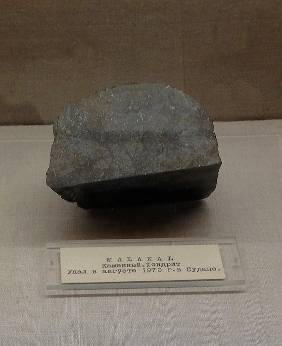
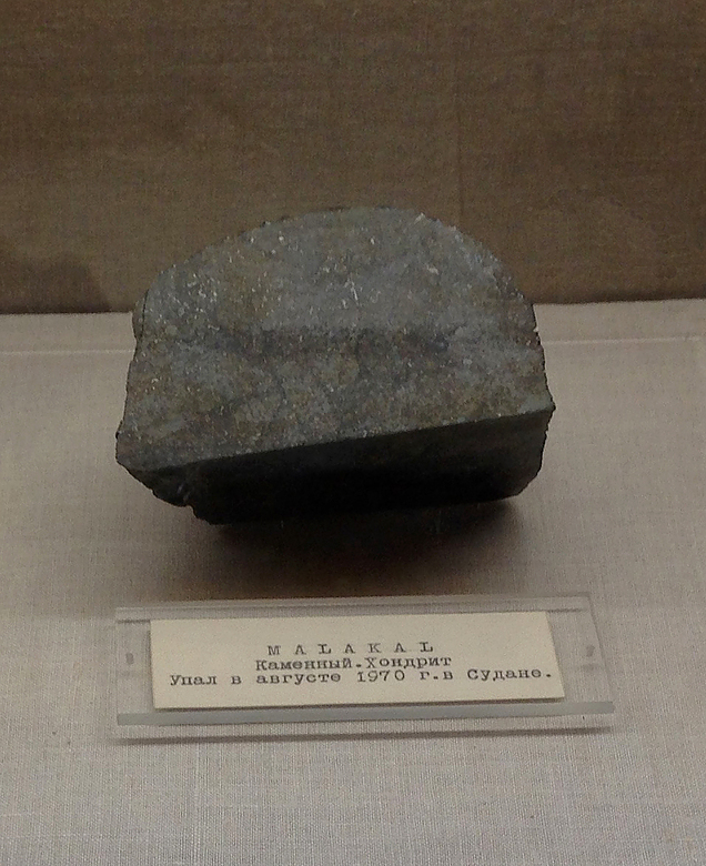
Malakal meteorite, Malakal, Upper Nile, South Sudan